
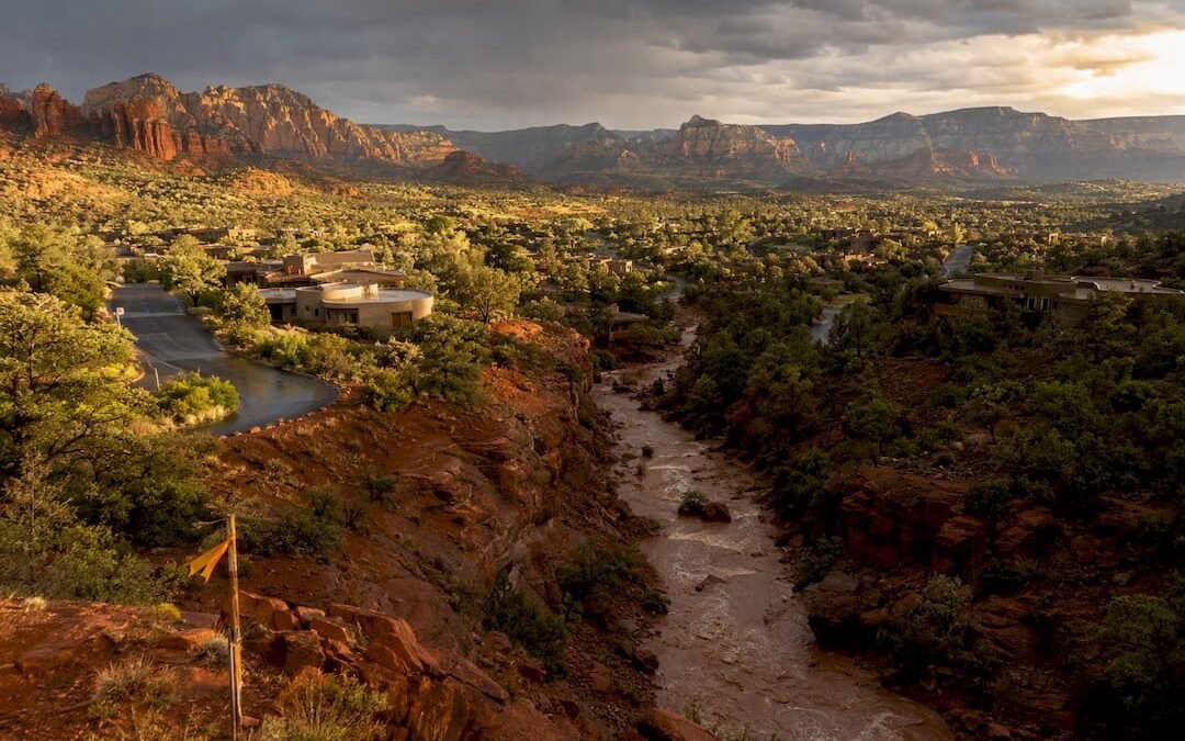
Sedona faces real flash-flood and erosion risk during monsoon season, but the danger is not spread evenly across town: it depends on your parcel’s location relative to washes, canyons, and burn scars. Some lots sit high and dry through the wildest storms, while others flood every few summers like clockwork. The first move for any owner or buyer is simple: check the NWS Flagstaff alerts page and look up your property’s FEMA flood zone explained before you do anything else.
TL;DR:
- Flood risk in Sedona varies greatly depending on the property’s proximity to washes, canyons, and burn scars, with some parcels flooding frequently.
- Updated flood maps became effective in early 2024, potentially reclassifying properties into higher-risk zones and triggering mandatory flood insurance requirements.
- Checking parcel-specific flood zone designations on FEMA’s tools and consulting local hazard reports is essential before buying or investing in Sedona real estate.
- An elevation certificate can lower flood insurance premiums and support dispute applications if a property was inaccurately mapped into a high-risk zone.
- Having a tailored flood emergency plan, identifying evacuation routes, and securing your property ahead of storms are crucial steps for safety during monsoon season.
Table of Contents
- What Makes Sedona Prone to Flash Flooding and Erosion
- How to Get Official Flash Flood Alerts Before the Water Arrives
- The Oak Creek Remapping and What Changed for Property Owners
- Steps to Assess, Insure, and Mitigate Flood Risk
- Where to Find Official Maps, Reports, and Local Help
- A Look Back at Sedona’s Flood History
- Building a Flash Flood Emergency Plan for Sedona’s Terrain
- Why Elevation Certificates Matter More Than Owners Expect
- Flood Control Infrastructure and Improvements Underway
- What Climate Trends Could Mean for Sedona’s Future Flood Risk
- What Flood Maps Really Mean for Sedona Buyers and Investors
- How The Equity Team Helps You Navigate Sedona Flood Risk
- Sources
- FAQ
What Makes Sedona Prone to Flash Flooding and Erosion
Sedona’s red rock scenery comes with a trade-off, and that trade-off is water that moves fast and hits hard. Monsoon storms roll through from July through September, dumping heavy rain in short bursts rather than steady, gentle showers. That intensity is the whole story here: a canyon that looks bone dry at noon can carry a wall of water by 3 p.m.
The town experiences a few different flavors of flooding, and they behave nothing alike.
- Flash floods surge through washes and canyons within minutes of a storm, often with little warning.
- Sheet flooding spreads shallow water across yards and roads during sustained downpours.
- Riverine overbank events happen when Oak Creek itself rises past its banks.
Erosion is the quieter troublemaker. A property doesn’t need standing water to suffer damage: fast-moving flow along a wash can chew through soil and undermine a foundation or a slope in a single storm, according to local flood control guidance on the region’s flood hazard. Recent wildfire burn scars make things worse, since scorched hillsides shed water instead of soaking it up, sending runoff downhill faster and in greater volume than the land ever intended.
How to Get Official Flash Flood Alerts Before the Water Arrives
The terminology matters more than most people realize. A Flash Flood Watch means conditions are ripe for flooding and you should stay alert; a Flash Flood Warning means flooding is happening or about to happen, and you need to act immediately. The NWS Flagstaff watches and warnings page is the authoritative source covering the Sedona area, and it spells out exactly which creeks, washes, and low-water crossings are expected to see impacts.
To stay ahead of a storm:
- Bookmark the NWS Flagstaff page and check it whenever monsoon clouds start building.
- Turn on Wireless Emergency Alerts on your phone; they arrive automatically with no signup required.
- Sign up for any county-level alert system offered through Yavapai County Flood Control.
- Treat a warning as your cue to move to higher ground and avoid any wash crossing, flooded or not.
Pro Tip: Never drive through a flooded wash, even a shallow-looking one. Sedona’s water moves fast enough to sweep a vehicle sideways in seconds.
If a warning hits while you’re home, secure loose outdoor items, move vehicles off low ground if there’s time, and stay away from windows facing a wash.
The Oak Creek Remapping and What Changed for Property Owners
Flood maps aren’t static documents, and Sedona just got a reminder of that. Yavapai County’s portion of Oak Creek received an updated flood map effective February 8, 2024, while the Coconino County portion became effective earlier, on March 21, 2023, according to the Oak Creek floodplain remapping fact sheet. Modern aerial surveying and updated modeling drove the change, and the practical result is that some parcels shifted flood designations overnight, even though nothing about the land itself changed.
Here’s why that matters:
- FEMA’s flood maps identify Special Flood Hazard Areas, meaning zones with a 1% or greater annual chance of flooding, and lenders use those maps to decide who must carry flood insurance, per FEMA’s flood map guidance.
- A property newly placed inside a high-risk zone can trigger a lender-required NFIP policy that didn’t exist the year before.
- Owners of newly mapped high-risk properties may qualify for a one-time discounted rate if they buy a policy within FEMA’s transitional window, per the same Oak Creek fact sheet.
- Anyone buying or selling near Oak Creek should pull a fresh designation rather than trust an old report, since remapping changes risk parcel by parcel.
You can check your own designation on FEMA’s Map Service Center and the National Flood Hazard Layer viewer, both of which let you download a FIRMette for the exact parcel in question.
Steps to Assess, Insure, and Mitigate Flood Risk
Once you know your flood zone, the real work starts. Here’s a practical order of operations for owners and investors alike.
- Pull your parcel’s status on FEMA’s National Flood Hazard Layer and request a local hazard report from the Flood Control District for anything near a wash or Oak Creek.
- Talk to an insurance broker about NFIP versus private flood coverage, and ask specifically about timing if your parcel was newly mapped into a high-risk zone, since that transitional discount window doesn’t last forever.
- Look at mitigation options: elevating structures, installing flood vents, regrading slopes, planting erosion-resistant vegetation, and respecting setback rules from washes.
- If you believe your property was mapped incorrectly, start a Letter of Map Change application. A LOMA or LOMR-F can remove the federal flood insurance requirement if FEMA agrees the designation was wrong, according to FEMA’s LOMC guidance.
- Gather an elevation certificate, recent survey data, and any supporting engineering reports before you file, since incomplete paperwork is the most common reason a LOMC request stalls.
Pro Tip: Order your elevation certificate before you list a property near Oak Creek. Buyers and their lenders will ask for it eventually, and having it ready speeds up the whole transaction.
For investors, flood exposure isn’t just a safety question, it’s a line item. FEMA notes that a property in a high-risk zone carries a significant chance of flooding over a standard 30-year mortgage, so that risk belongs in your underwriting and your contingency reserve, not as an afterthought discovered at closing, per FEMA’s own explanation of flood map risk.
Where to Find Official Maps, Reports, and Local Help
You don’t need to guess at any of this. A short list of trustworthy stops covers nearly everything a Sedona owner or buyer needs.
- The Yavapai County Flood Control District handles parcel-level hazard reports and Oak Creek remapping questions.
- FEMA’s Map Service Center and National Flood Hazard Layer viewer provide parcel lookups and downloadable FIRMettes.
- The NWS Flagstaff page covers real-time watches and warnings for the Sedona area.
- Licensed surveyors, floodplain consultants, and Arizona-based insurance brokers can fill in the gaps maps alone can’t answer.
A Look Back at Sedona’s Flood History
Oak Creek and its side canyons have a long habit of overflowing during intense monsoon activity, which is exactly why Yavapai County keeps updating its maps instead of leaving them alone. The remapping project itself exists because older models underestimated how fast and how far water moves through this terrain, and newer aerial data painted a more accurate picture, one that shifted several properties into higher-risk categories.
That pattern, storms arriving in short, violent bursts rather than prolonged soaking rain, is the throughline across the area’s flood history. It’s less about a single catastrophic flood and more about a recurring rhythm: a hot, dry summer, a sudden monsoon cell, and a wash that goes from empty to raging in the time it takes to finish a cup of coffee. Properties tucked close to Oak Creek or seasonal washes have historically borne the brunt of that pattern, while homes on higher ground away from drainage channels have largely stayed dry.
The lesson for today’s buyers isn’t that Sedona floods constantly, it’s that when it floods, it floods fast and with little warning, and the areas affected tend to be the same low-lying corridors year after year. That’s exactly why parcel-level map data matters more here than a general sense of the town’s overall risk.
Building a Flash Flood Emergency Plan for Sedona’s Terrain
A flash flood plan for Sedona looks a little different than one built for a flat, low-lying floodplain elsewhere, mostly because the warning window here can be shockingly short. Canyon geography means a storm miles away can send a flood your direction before local skies even look threatening.
Start with routes, not supplies. Know at least two ways out of your neighborhood that avoid wash crossings entirely, since a single blocked route in flash-flood country can trap you. Identify the nearest high ground you could reach on foot if roads become impassable.
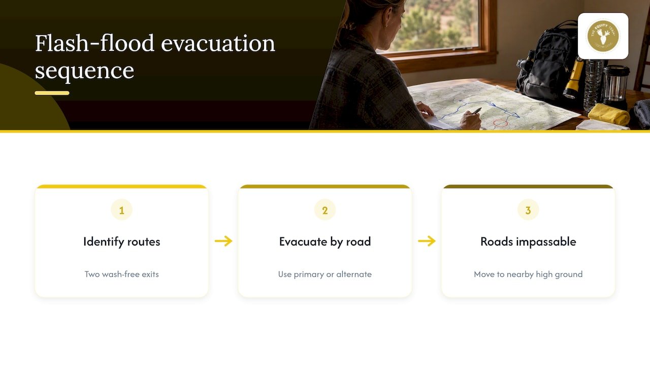
Keep a small go-bag with copies of insurance documents, medications, a flashlight, and a portable phone charger, since power and cell service can wobble during severe storms. Set your phone to receive Wireless Emergency Alerts and check the NWS Flagstaff page whenever monsoon buildup looks likely on the horizon.
If you own a short-term rental, build flood instructions into your guest communications: a simple note about avoiding washes during storms and where the nearest high ground sits can prevent a scary situation for renters unfamiliar with the terrain. Review your plan every spring, before monsoon season ramps up, since driveways, fences, and landscaping change year to year and can affect your safest route out.
Why Elevation Certificates Matter More Than Owners Expect
An elevation certificate documents exactly how high a structure sits relative to the base flood elevation, and it’s the single document that most influences your flood insurance premium and your options if you dispute a flood zone designation. Without one, insurers often default to the most conservative, and most expensive, assumptions about your risk.
For owners near Oak Creek or any mapped wash, an elevation certificate does double duty. It supports a Letter of Map Change application if you believe your parcel was misclassified, since FEMA requires elevation data as part of that LOMC review, and it can also unlock lower premiums if your structure sits above the base flood elevation despite being mapped into a high-risk zone.
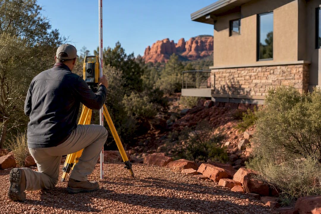
Sellers benefit too. A current elevation certificate in hand at listing time answers a question buyers and lenders will ask anyway, and it can shorten negotiations considerably. Investors evaluating a short-term rental near a wash should treat the certificate as a line item in due diligence, right alongside inspection reports and title work, not as an optional extra to chase down later.
Flood Control Infrastructure and Improvements Underway
Yavapai County’s Flood Control District doesn’t just draw maps, it manages the physical systems meant to keep water where it belongs. The Oak Creek remapping project itself reflects ongoing investment in better data, using modern aerial surveys and updated hydraulic modeling rather than decades-old assumptions, according to the district’s own fact sheet.
Beyond mapping, the district maintains channel and drainage infrastructure designed to move stormwater through developed areas without flooding roads or structures. Setback requirements near washes exist for a reason: they keep new construction out of the paths water is most likely to take, reducing both flood and erosion exposure for future owners.
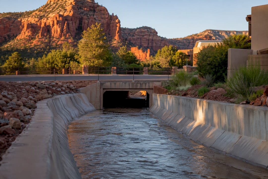
For residents and investors, the practical implication is that flood risk in Sedona isn’t a fixed number carved in stone. It shifts as infrastructure, mapping technology, and local drainage patterns evolve, which is exactly why checking current data before a purchase matters more than relying on what a neighbor or a past appraisal said five years ago.
What Climate Trends Could Mean for Sedona’s Future Flood Risk
Monsoon patterns across the Southwest have shown signs of intensifying in recent years, with heavier rainfall arriving in shorter bursts rather than spread evenly across the season. For a town built around canyons and washes, that kind of shift matters more than a simple increase in annual rainfall totals would.
Wildfire activity compounds the picture. Burn scars strip vegetation that would otherwise slow runoff, and a hillside that burned this year can behave completely differently during next year’s monsoon than it did before the fire. That combination, more intense storms meeting more burn-scarred terrain, is part of why local agencies keep revisiting their flood models instead of treating older maps as permanent.
None of this means every Sedona property will see rising risk at the same pace. It does mean that today’s flood zone designation is a snapshot, not a guarantee, and owners and investors should expect maps to keep evolving as new data comes in. Checking your parcel’s status periodically, rather than once at purchase and never again, is the most reliable way to stay ahead of a risk picture that keeps shifting under everyone’s feet.
What Flood Maps Really Mean for Sedona Buyers and Investors
Buyers react to new flood maps the way you’d expect: with hesitation, extra questions, and sometimes a renegotiated price. A parcel that shifts into a high-risk zone can cool interest fast, even when the actual physical risk barely changed. Clients are guided through understanding what a designation means, which documentation to request, and when to consult an insurance broker before a contingency deadline.
The pattern holds across Sedona’s short-term rental market as much as anywhere else: informed buyers negotiate better, and informed sellers close faster.
— Chad
How The Equity Team Helps You Navigate Sedona Flood Risk
Buying or selling near a wash or Oak Creek adds a layer of due diligence that a typical Sedona transaction doesn’t need, and that’s exactly the kind of detail Flood-zone review is included as a standard part of due diligence.

- Buyer and seller representation offered, including flood-zone review as part of due diligence.
- A Sedona Home CMA or Sedona vacation rental CMA that accounts for flood-map status when pricing a property.
- Referrals to local surveyors, floodplain consultants, and insurance brokers knowledgeable about flood products.
- A rental exit strategy conversation for owners weighing whether a newly mapped flood zone changes the math on holding versus selling.
If you’re buying, selling, or reconsidering a Sedona short-term rental and want flood risk handled properly instead of glossed over, start a conversation with The Equity Team today.
This article is general information, not a substitute for advice from a qualified financial advisor. Consult a qualified financial professional about your own circumstances before acting on anything here.
Sources
- Flood maps | FEMA
- Watches, Warnings & Advisories (NWS Flagstaff)
- Local flood hazard — Yavapai County Flood Control
FAQ
Is Sedona at high risk for flash flooding?
Sedona faces meaningful flash-flood and erosion risk during monsoon season, but exposure varies a great deal by parcel. Properties near washes, canyons, or Oak Creek face far greater risk than those on higher, drier ground, so checking your specific parcel on FEMA’s flood map tools matters more than a general answer.
How did the Oak Creek remapping change flood insurance requirements?
Updated flood maps for Oak Creek became effective February 8, 2024 in Yavapai County and March 21, 2023 in Coconino County, and some properties shifted into higher-risk zones as a result, according to the Yavapai County fact sheet. Properties newly placed in a high-risk zone can trigger a lender-required flood insurance policy, though a discounted rate may be available if the policy is purchased within FEMA’s transitional window.
What is a Letter of Map Change and when should I file one?
A Letter of Map Change, or LOMC, is a request to FEMA to correct a property’s flood zone designation if you believe it was mapped incorrectly. If approved as a LOMA or LOMR-F, it can remove the federal flood insurance requirement, according to FEMA’s own guidance, though you’ll need an elevation certificate and survey data to support the request.
Where can I check my Sedona property’s official flood zone?
FEMA’s Map Service Center and National Flood Hazard Layer viewer let you look up any parcel’s flood designation and download a FIRMette. For Sedona properties specifically, the Yavapai County Flood Control District can also provide a local parcel hazard report that adds erosion and drainage context maps alone don’t capture.
Does The Equity Team help buyers evaluate flood risk before purchasing?
Yes, The Equity Team factors flood-zone status into due diligence for buyer and seller representation, including CMAs for standard homes and short-term rentals. Reach out through Owninaz to start that conversation before you write an offer near Oak Creek or a mapped wash.